Most of us punch our destination into a mapping app and trust it to guide us. But here’s a dirty little secret: those apps often ignore elevation changes. Flat or hilly, they treat every mile the same.
In reality, climbing a mountain pass burns more fuel and takes longer than cruising along a coastal highway. Let’s find out why elevation matters, how it impacts your trip, and look at some route examples to bring it home.
Why Elevation Throws a Wrench in Your Plans
Elevation isn’t just a number on a trailhead sign. It’s a physical force that makes your engine work harder. When you’re driving uphill, your vehicle fights gravity, burning more fuel to maintain speed. Downhill stretches might seem like a freebie, but braking to control speed and navigating tight switchbacks can slow you down. Mapping tools like Google Maps or Waze rarely account for this, leaving you with optimistic ETAs and fuel estimates.
The science is straightforward. A car’s fuel efficiency drops as the grade (steepness of the road) increases.
Studies show that a 5% uphill grade can cut fuel economy by 15-20% compared to flat terrain.
Add in thinner air at higher altitudes, which reduces engine efficiency, and you’ve got a recipe for longer travel times and emptier wallets.
The Fuel Efficiency Hit
Let’s get technical for a sec. Internal combustion engines rely on a precise mix of air and fuel. At sea level, there’s plenty of oxygen for efficient combustion. Climb to 8,000 feet, and the air thins out.
Your engine either compensates by injecting more fuel (if it’s carbureted) or struggles to maintain power (if it’s fuel-injected). Either way, you’re burning more gas to go the same distance.
Hybrids and electric vehicles aren’t immune. EVs lose efficiency on steep climbs because motors draw more power to overcome gravity. Regenerative braking on descents can recoup some energy, but not enough to offset the climb.
A 2020 study by the American Automobile Association found that EVs lose about 10-15% of their range when driving in mountainous terrain compared to flat routes.
Travel Time Takes a Beating
Elevation doesn’t just sap fuel—it messes with your schedule. Steep roads often mean slower speeds, tighter turns, and more frequent stops for overheated engines or nervous drivers. Mountain passes can also bring weather surprises, like snow or fog, that further delay your trip. A mapping app might say it’s 100 miles from point A to point B, but if those miles include a 4,000-foot climb, you’re not hitting that ETA.
Trucks and RVs feel this pain acutely. Their heavy loads and lower power-to-weight ratios make climbs a slog. A semi-truck crawling up a 6% grade at 20 mph isn’t just burning fuel—it’s adding serious time to the journey.
Even passenger cars notice the difference. A 2018 study by the University of Colorado found that routes with significant elevation changes can increase travel time by 10-25% compared to flat routes of the same distance.
Example Route Denver to Vail
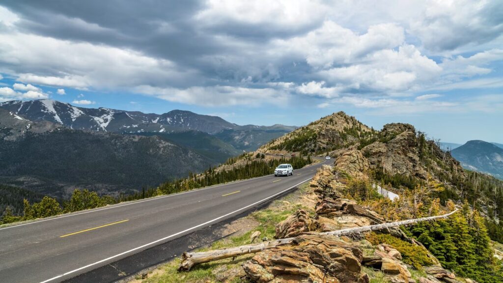
Let’s nerd out with a classic Rocky Mountain drive: Denver to Vail, Colorado. It’s about 100 miles via I-70, with a jaw-dropping climb from Denver’s 5,280 feet to Vail’s 8,150 feet, peaking at the Eisenhower Tunnel around 11,000 feet.
Google Maps might peg this at 1 hour 45 minutes without traffic. Sounds reasonable, right?
Not so fast. The climb up I-70’s steep grades (some hitting 7%) forces your engine to work overtime. You’re burning through fuel at a rate closer to 15-20 mpg for a typical sedan, compared to 25-30 mpg on a flat highway.
The thinner air at high altitude saps another 5-10% of your efficiency. Add in curves, construction, and the occasional slow-moving RV, and you’re looking at 2 hours or more, especially in winter.
Compare that to the raw data. A 2019 analysis of GPS-tracked vehicles on this route showed average travel times closer to 2 hours 15 minutes, with fuel consumption 20% higher than flat routes of similar length.
If you’re driving a gas-guzzling SUV, you might burn 6-7 gallons for this trip, compared to 4-5 gallons for a flat 100-mile drive.
Example Route San Diego to Los Angeles
Now, let’s contrast that with a coastal cruise: San Diego to Los Angeles, about 120 miles via I-5. This route sticks close to sea level, with gentle elevation changes rarely exceeding 500 feet.
Google Maps estimates 2 hours, and it’s usually spot-on. Why? The flat terrain lets your car hum along at a steady 65-70 mph, sipping fuel at an efficient 25-30 mpg for a typical sedan.
There’s no fighting gravity here. The straight, wide freeway minimizes sharp turns or slow climbs. A 2021 study by Caltrans found that fuel efficiency on I-5 between these cities is near-optimal, with most vehicles achieving 90-95% of their EPA-rated highway mpg.
Travel time is predictable, and you’re burning about 4-5 gallons of gas for the trip—roughly 25% less than Denver to Vail, despite the longer distance.
The Data Dive
Want to geek out further? Let’s look at the numbers. The U.S. Department of Energy provides a handy formula for estimating fuel consumption based on grade:
Fuel Consumption (gallons/mile) = Base Consumption × (1 + 0.03 × Grade Percentage)
On a flat road (0% grade), a car averaging 25 mpg uses 0.04 gallons per mile. On a 6% grade, that jumps to 0.0472 gallons per mile—a 18% increase. Over 100 miles, you’re burning an extra 0.72 gallons. For a $4/gallon gas price, that’s nearly $3 more per trip. Scale that up for trucks or long-haul routes, and the costs pile up fast.
Travel time gets trickier to model, but GPS data from apps like Strava or fleet management systems shows clear trends. A 1,000-foot elevation gain over 10 miles can add 5-10 minutes to a trip, depending on vehicle type and road conditions. For routes with multiple climbs and descents, like Denver to Vail, the cumulative effect is significant.
Fuel Efficiency Calculator
Estimate fuel use based on distance, vehicle MPG, and road grade.
Practical Tips for Elevation-Aware Travel
So, how do you outsmart elevation? First, check your route’s elevation profile. Apps like Gaia GPS or websites like FlattestRoute.com can show you the climbs and descents. If you’re driving a gas vehicle, top off the tank before hitting the mountains—gas stations can be sparse, and you’ll burn more than you expect. For EVs, plan charging stops carefully, as range drops faster in hilly terrain.
Drive smarter, too. Maintain a steady speed on climbs to avoid overworking the engine. On descents, use engine braking (downshifting or low gear) to save your brakes. If you’re in a hybrid, maximize regenerative braking by easing off the accelerator early. And pack light—every extra pound makes your engine work harder against gravity.
The Future of Elevation-Savvy Navigation
Mapping tech is slowly catching up. Some GPS systems, like those in Tesla vehicles or Garmin’s outdoor models, factor in elevation for more accurate range and time estimates. But mainstream apps still lag. Imagine a future where your navigation app reroutes you to avoid a steep pass, balancing time, fuel, and safety. Researchers at MIT are working on algorithms that optimize routes for energy efficiency, but we’re not there yet.
Until then, elevation remains the hidden variable in your road trip. Whether you’re carving through the Rockies or cruising the coast, understanding its impact can save you time, money, and frustration. Next time you’re planning a drive, don’t just trust the app—check the terrain and plan accordingly. Your car (and your wallet) will thank you.
Final Thoughts
Elevation isn’t just a fun fact for hikers—it’s a real factor that shapes how we travel. From the fuel-sucking climbs of I-70 to the easygoing flats of I-5, terrain matters. By understanding its effects and planning ahead, you can make smarter choices on the road. So, next time you’re headed to the mountains, pack some patience, fill up the tank, and enjoy the ride—just don’t be surprised when it takes a little longer than Google says.